Nanjing Normal University (China) The Launching And Implementation Meeting Of The National Key R&D Project OneGIS Was Held In Beijing
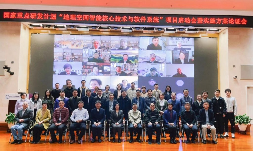
On March 25th, 2022, led by the Institute of Geographic Sciences and Natural Resources Research, CAS (IGSNRR), The launching and implementation meeting of the National Key R&D project OneGIS was successfully held in Beijing, jointly undertaken by 10 institutions, including Digitwinology International (Kunshan), Zhejiang University, Nanjing Normal University, etc.
More than 130 people in total attended the meeting either online or in-person, including leaders from the Key Special Management Office of Earth Observation and Navigation, the Ministry of Science, the Bureau of Science & Technology for Development, CAS, IGSNRR, and the Office of Academic Research, as well as academicians and experts related to the 12th, 13th, and 14th Five-year National Key R&D Plans. Chenghu Zhou, the leader of the project, talked about the overall implementation of the project on behalf of the whole team. The experts agreed with his plan. And, after giving constructive suggestions one after another, the experts finally agreed unanimously that the plan for implementation passed the evaluation.
The OneGIS project is the first and only GIS project included in the 14th Five-year Plan. Led by academician Chenghu Zhou, a total of 10 institutes have formed a strong R&D team integrating industry, university, and research. Thus, a strong scientific expert committee for the steering of the project has been established. The project aims to be the contemporary international scientific frontier of GIS, satisfying the demands of the national economic construction and major strategy. It strives to create original object space modeling theories and methods and develop a new generation of geospatial intelligent software system based on cloud-native architecture and a “data-knowledge-mode” triad to promote the leapfrog development of China’s GIS.
Nanjing Normal University is the leader of Project-3: Geospatial Knowledge Atlas and Knowledge Base Engine. The project leader is Professor Xueying Zhang from the School of Geographic Science, and the research team includes more than 30 researchers from Wuhan University, Central South University, Beijing GEOWAY Software Co., Ltd., and other sub-research units. The research objective of Project-3 is to establish the theory, method, and technical system of geographic space knowledge, and develop a “graph-text-data” integrated base engine and management system based on cloud-native architecture. The total funding for Project-3 is 10 million yuan, of which 6 million yuan has been allocated from China. Professor Min Cao, Associate Professor Songshan Le, and other core members from the School of Geographic Science also participated in this project.
In the year 2022, NNU has been selected once again as one of the national “Double First-Class” universities, and Geographic Science has again been selected as one of the “double First-Class” disciplines. In the new round of the “Double First-Class” construction, the School of Geographic Science will always adhere to the guidance of Xi Jinping Thought on Socialism with Chinese Characteristics for a New Era, centering on the new orientation, new mission, and new requirements. All other departments in NNU will fully support the development of the project and ensure the smooth completion of the research to further deepen the development of geographic science as well.